Monday, 19 November 2012

Choquequirao to Machu Picchu : Choquequirao and Pinchaunuyoc (Day 3)

Choquequirao


Choquequirao ('Cradle of gold' in Quechua) is known to many as "the other Machu Picchu". The city was built by Inca Pachacutec successors Tupac Inca Yupanqui (1471-1493) and Wayna Capac (1493 - 1527). It was probably one of the entrance check point to the Vilcabamba region, and also an administrative hub serving political, social and economic functions. The Manco Inca dynasty also used this fortress to resist the Spanish from 1536 to 1572. (Source: http://www.peru.travel/en/culture/archaeology/choquequirao-1122-2-567-4.1.14)


The clouds were low when we started out from our camp. Very soon, we passed by stone walls, the first semi-restored houses and the priest's house. 
Stone wall along trek
Priest's house on higher grounds
and overlooking both sides on the canyon
We climbed higher to the ceremonial plaza dedicated to sun worship. From the plaza we had the first glimpse of how big this lost city could have been. The restored houses, terraces, warehouses and aqueducts appeared right below us:
Buddy, José and I at Choquequirao
According to the Peru tourism office, only 40% of the city has been evacuated. Under the thick forest vegetation lies farming terraces built by experienced farmers who knew what to plant at the different altitude. Even more amazing was how the Incas used aqueducts to direct water from the glacier springs across the mountains into the city. 

From the ceremonial plaza, we also saw the only trek that led us in. It would have been the only access back in the ancient times too:

The only way in 
Our tiny tent

We descended from the clouds to explore the restored buildings.


José explained that it would appear that these were 2 storey houses, with the second floor used to store food. The large windows on the top floor allowed for air circulation and kept the food dry. The niches in the wall on the ground floor are thought to be used to display mummies.

José also pointed out some of the flaws of the restoration works. Many of the restored doorways and windows are rectangular instead of the traditional trapezoidal Inca style. Some of the stonework around the aqueducts also do not match.


We saw some stone tools made of stone lying around:

We sat on the plaza and chatted with others whom we have met on the trek. Noticed the lack of tourists in my earlier photographs? Well, that was because there were only 9 of us (the 3 of us and 2 groups of 3 independent hikers) on the grounds and we have met on the previous days. There were no officers, no tourists. Just us and 2 dogs.
(A side story about the dogs: the boys had picked up the first dog at Cachora and when they crossed the river, a horny male dog joined them at Santa Rosa. Horny male could not stop his horny attempts made on female dog for a second - hence guy in black is trying to push horny male dog from female dog hiding in between his legs.)


We had only seen the restored thus far. Next came the best part of Choquequirao - the original llama walls. We first had to walk down the terraces: 


Each step is this high:

We walked across the terrace and to the next hill and Voila!:

The llama walls
There is a shepherd:

with his llamas in the mountains:


The Incas worshipped the sun and had everything important built facing the east. The llama wall, on the other hand, faces the west. José told us a story of how the Incas, trying to escape from war, could not bring their llamas along with them. They built the wall of llama instead and each evening, watch the llamas come to life in the setting sun. He also told us how the llamas on the walls looked like babies at the bottom rows, slowly growing up, finding a partner and forming a family. What do you see?


So, the bad news have been: 
- the present Choquequirao site we saw is probably 90% restored and 10% original - what was restored were probably rubbish
- and personally, it was a shame I did not visit the walls in the previous evening

The good news are:
- the llama walls are originals and unique
- 60% of Choquequirao on the mountains that have not been excavated and there is still hope to do it right!
- there was no entrance fee to Choquequirao
- we had the whole place to ourselves (later, I would discover that it is impossible to take a photograph in Machu Picchu without a tourist in it)

I like what is untarnished in Choquequirao. Do go to Choquequirao before it becomes the next Machu Picchu.

Pinchaunuyoc

From Choquequirao, we hiked over a ridge to Pinchaunuyoc. 
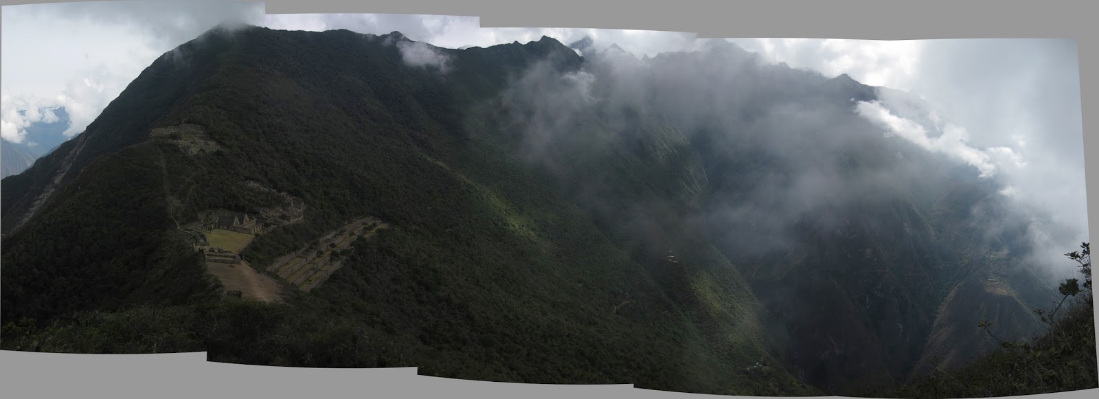
Valley viewed from Choquequirao
We did not see any spectacled bears as I would have hoped but saw more new plants and stone tools.
The Pinchaunuyoc campsite came as a surprise - our own terraces!
Pinchaunuyoc
Buddy and I went down to the bottom of the terrace and I lost count of how many steps there were after the 300th or so step.
View from the bottom of terrace. Our tents, circled, on the top left corner of this photo
When we climbed up, we forsake the normal stairs and took the protruding stone steps on the wall of the terraces instead. I found it easier than climbing the stairs.

At our camp, I took off my shoes and my feet were promptly attacked by the flies. More woes awaited. It turned dark quickly and began to rain after dinner.

It rained and stopped for half an hour, rained harder and stopped and rained and stopped... I woke up every hour to check if my tent was leaking. Then I found my day pack wet, with a pool of water nearby. I quickly put the day pack in a plastic bag and everything else in zip lock bags and into the duffel bag. I proceeded to dry the water on the ground sheet in the tent, checked if my foam mattress is wet (thankfully it was not) and the source of the water. I could not find the source of the leak and went back to sleep.

Top of tent was getting very wet

The next time I woke up, I found that the bottom of my mattress was soaked with water and the water has travelled up and my sleeping bag was wet. Faint! The other side of the tent where I dried earlier has miraculously stayed dry. Initially I had wanted to sit on my mattress till dawn but it was only 3am! I struggled to stay awake for a while when a brilliant idea struck. I put my poncho on my mattress, put on my waterproof jacket and pants and slept on the poncho without my sleeping bag. 


Finally - daybreak


Sunday, 18 November 2012

Choquequirao to Machu Picchu : Introduction, Days 1 & 2

Fact of climbing: What goes down, must go up and up and up. Then some more (URGH!). (Random thought as I walked. Serves me right.)

Trekking to Machu Picchu

There is the easy option of getting to Machu Picchu: Take a taxi from Cuzco to Poroy or Ollantaytambo (20 minutes), then a slow train to Aguas Caliente (4 hours, from US$90 for a return ticket) and lastly a bus to Machu Picchu (20 minutes, US$17 for a return ticket)

Then there are the trekking options to Machu Picchu - from the 4-days Inca Trail to 6-days Salkantay trek to 9-days Choquequirao trek or even 17-days Vilcabamba traverse. The Peruvian government issues 500 permits daily for the Inca Trail and one often has to booked many months in advance for a permit. 

I was more interested in the Salkantay Trek and the Choquequirao trek as there are less tourists on these routes and one hikes on a higher altitudes closer to the mountain tops. Eventually, I chose the latter because of the visit to Choquequirao and that there are very few who trek on this route. I was really glad I made this choice as I like Choquequirao more than Machu Picchu, love the landscape on this trek and met some interesting people along the way.


Summary of the trek


My 9-day programme effectively consisted of only 7 days of walking and a short hike on Day 9. The estimates are:

[Note that the ascent and descent kind of differs from the operator's numbers (my numbers are smaller. For example, according to their website, Day 4's ascent is 2000m. Mathematically, it did not quite make sense to me.]


On the map, it would look something like this (pardon the quality of the picture):
I also had it easy - we had mules to carry our backpacks and equipment (due to the relative difficulty of this route, mules instead of human acted as porters). Along the way, we met some people who trekked independently, carrying their own backpacks and tents and some hired mules along the way.


Day 1 Cuzco to Chiccisqa

I met José, my guide, at 6am and he informed me that a second person, Buddy has joined the trek. Hurrah! We picked up Buddy and Astario, our chef and set off to Cachora. The drive was uneventful - we introduced ourselves, chatted and napped on the second part of the drive. Buddy was travelling on an overland trip in South America for 3 months and had arrived on a overnight bus from Puno.
Buddy and José
Champion chef Astario balancing his chopping board on his thighs
We descended from chilly Cuzco to sunny Cachora and had an auspicious start - at the beginning of our hike, we saw more than 10 green parrots in the sky. Very soon into the trek, Buddy and I discovered that we were loved by the sun, the mosquitoes and flies. We first found bites on our elbows (why elbows, mossies?) and started to vigilantly apply our sun screen and insect repellant. 
Thankfully it is not 150km but 'only' 31.5km from Cachora to Choquequirao
We reached our picnic spot, Mirador de Capuliyoc, for lunch without being caught up by the mules (normally, the mules would start off later but catch up with trekkers quickly). The ascent had been fairly easy and the view at Capuliyoc was spectacular:
We also saw a gigantic humming bird. After lunch, we continued with our scenic walk. I saw many plants and insects for the first time, including a Goliath birdeater which was as big as my hand.
Can someone tell me what is this?

Goliath birdeater
Mealybug, a parasite on cactus


Locals dry mealybugs in the sun and
squash them to produce red dye for their cloth
We reached our campsite at Chikisca, where a local family resided. I was so happy to see the family extracting sugar cane juice (my staple drink when skating) and promptly bought myself a glass. It was very sweet. Pity there was no ice! 
Sugar cane press
Turkeys at campsite
View from tent and sun was about to set
At the campsite, we met Kirk, who was trekking independently. Poor Kirk's shoe failed him and he had to use duct tape to hold the toe cap to the sole. 
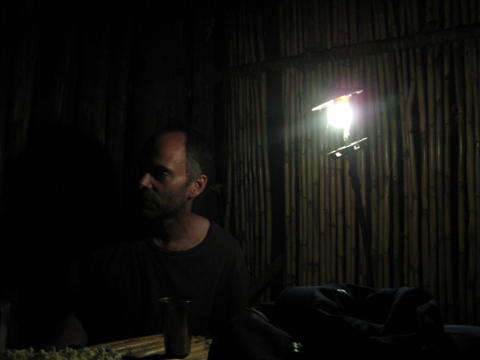
Chatting to Kirk by the kerosene lamp
[I was trying to capture the lamp, not Kirk (sorry mate!)
I have not seen a kerosene lamp since I was 16!]
That night, it rained for the third time on my rtw trip. Fortunately, nothing flooded.

Day 2 Chiccisqa to Sunchupata

We started early and trekked down to the Apurimac River. On the previous night, Kirk told me I had to cross the river in a basket that skimmed the surface of the river and José told me I had to swim across. What greeted us was not exactly very encouraging:
Bridge that has been washed away by the river
The moment of truth came - we had to sit in a cage and pull ourselves across the river on a cable. One can imagine how excited (NOT!) I was. Thankfully, José, Buddy and my combined bodyweight took us across most of the river without much issues. Phew!
Cage
Photo credit: José
Iron cable
Apurimac River
We met our new horse'men', Gunda and Johan across the river. They were only 18 years old and would be with us for the next 6 days.
Gunda and Johan with the mules
The mules need to be blindfolded before the bags are loaded on them
The first part of the ascent to Santa Rosa was not too bad. I managed to take more pictures of some unfamiliar looking plants.
Does this not look like sakura in bloom?


I discovered the granadilla for the first time in my snack pack (yes, I have a snack pack every day and Kirk would be very jealous). The edible part of the fruit is slimy/gel-like with a lot of seeds, like the passion fruit but it is very sweet (in season in October). On first sight, I thought it looked like frog eggs but it was a refreshing fruit to have in a hot day. José said that when 4 of these are eaten in one go, the bowels would be cleared immediately. 
Granadilla
The 870m ascent from Santa Rosa to Marampata was slightly nightmarish - steep and it was very very hot. I nearly melted. The 15 switch-backs took forever to complete and we were rewarded by the first glimpse of Choquequirao and lunch.
Nap time
I refuse to nap
After lunch, we proceeded to Sunchupata, our campsite near Choquequirao. From our lunch stop, we could already see some terraces on the distant hills. It was very exciting as we approached and saw the terraces on the very steep slopes:
Choquequirao terraces in very harsh light
Terraces and fountains
Choquequirao beckoned.


Saturday, 17 November 2012

Cuzco Cusco Qosqo

After spending 8 days in the mountains, in the jungle and on the seas respectively, I am really behind time with updating my blog (understandably there was next to no wifi in these remote areas). Let us rewind to 12 October when I went to Cuzco, Peru.

A brief history of Inca and Cuzco

The Incas (like the Romans) was one of the world's great civilisation. They were known to be highly organised, using large armies of soldiers and people and leaving behind legacies of huge agriculture and building projects.  They observed and respected nature - the stars, the river and the mountains.

Cuzco, 3399m above sea level, was the geographical and spiritual capital of the Incas (1400 - 1532). A fortress, Sacsayhuamán (“satisfied hawk” in Quechua, the Inca language), was built on a hill to protect Cuzco from the enemies. Away from Cuzco, the Incas demonstrated their organisation and architectural superiority through mysterious cities such as Machu Picchu, Choquequirao that were built for the kings' retreats. (Source: www.visitperu.com)

In a period of less than 100 years, the Incas expanded from Peru to modern day Bolivia, Ecuador, Columbia, Argentina and Chile. Remarkably, this was done with spoken Quechua, diplomacy and little force and without the use of a written language. (Source: www.adventurespecialists.org) Vital to the Inca expansion was the construction of thousands of kilometres of roads that maintained networks with Cuzco.

A sudden spread of small pox and other diseases, the sudden death of the Inca king Huayna Capac resulting in a feud between his 2 sons for the throne and the arrival of the Spanish led to the eventual demise of the Inca kingdom and Spanish colonisation from 1532 to 1821. 
Cathedral at Plaza de Armas

The Spanish brought with them, their language, European art, culture and Catholicism. Unfortunately, they also destroyed many of the Inca temples and properties and built their churches over these sites. Sites like Sacsayhuamán was also not spared - it was used as a quarry to provide stone for colonial buildings due to the fact that it was close to Cuzco.
What is remained of Sacsayhuamán
Church procession in Cuzco 


Present day Cuzco

The present day Cuzco is a tourist hub for those who want to visit the archaeological sites in the sacred valley, salt flats and most importantly, Machu Picchu. Needless to say, there are many hotels in the city and even more laundry shops and expensive restaurants. Spanish is the main spoken language and many hotel and restaurant operators also speak English. There are very few people in the traditional costumes and some of them will demand money if one wants to take a picture of them and/or their llama. 

How I got to Cuzco

Most would have arrive at Cuzco on a plane from Lima (most cities in Peru are connected via Lima), a bus from nearby cities or on the Andean Explorer, a tourist train from Puno.

I took a tourist bus from Puno to Cuzco, on which I saw my first snow-capped mountain in Peru (La Raya, 4335m), archaeological sites (Pukara and Raqchi) and one of the sources of Amazon River (Urubamba River). The bus ride was very comfortable and took about 10 hours (inclusive of lunch and sight-seeing).

La Raya pass
Human sacrifices evidenced in Pukara,
where statues with decapitated head
and dagger were found


Remains of Inca temple at Raqchi

My Cuzco


From what I saw on the bus trip into the city, I had rather low expectations of the Cuzco town centre. However, when I first walked into main square, Plaza de Armas, I was pleasantly surprised by the lights in the square and on the hills (one must understand, I have adapted to the dim/ lack of lights in Puno and Lake Titicaca). It was pretty.
Tourists are approached by sales people selling massages, crafts and restaurants but they are not pushy or threatening. With the number of policemen and tourists milling around, it felt very safe to walk about the main square at night. 


October is probably not within the high tourist season. Accommodation (ranging from basic hostels to high-end hotels) are therefore fairly easily available. 

Food-wise, most restaurants are expensive. My favourite 'restaurants' are found in the San Pedro market. The market is organised into sections such as crafts, clothes, home wares, raw food (vegetables, fruits, meat) and cooked food (rice, juice and dessert).
In the cooked food section, customers sit like packed sardines on benches in front of the stalls. Competition is stiff - in the juice section for example, there are at least 18 stalls (3 rows of 6) selling the same type of fruit juice at the same price. The more popular stalls are always crowded and would have 2 rows of benches in front of the stall (instead of just 1 row of benches). 

After having meals for at least 30 soles (about US$12) per meal, I was so happy to find this market. Needless to say, I had to join the locals at the most crowded stall. The damage for this huge bowl of pasta and drumstick in chicken soup? 3.50 soles and one can even ask for more pasta and soup at no extra cost! 


Like many, I was in Cuzco to acclimatise before my trek to Machu Picchu. I walked up the hill to Cristo Blanco and fortunately, I did not experience breathlessness nor altitude sickness. I guess the earlier acclimatisation at Puno had helped.
Cristo Blanco, a gift from Palestinians
View from Cristo Blanco - Cuzco city in the middle and Sacsayhuamán (terraces) on the right