Sunday, 25 November 2012

Choquequirao to Machu Picchu : Tips and considerations

The Choquequirao to Machu Picchu trek was not one of the hardest trek I had done so far but it was one of the hottest (I did it during mid-October). I was not very fit and still managed to complete each day before the timeframe stated on the trek operator's website. I would love to recommend this trek to anyone - visit Choquequirao before it is connected to the outside world via public transports and roads.    

Trekking independently

Independent trekking is possible so long you can carry your own tent or know how to hire a muleteer and his mule. When it is not the peak season, there is an option to hire mules along the way when one tires out (as in, you may not need a mule for the whole trip). You may not even want to trek from Cachora to Machu Picchu. Another option is to trek from Cachora to Choquequirao, return to Cuzco and take public/ private transports to Machu Picchu.

Finding camping grounds should not be an issue. I think the supply of land is adequate. One just walk to a village, find the patch of grass you like and negotiate with the villager on the price I think. 

Foodwise, most of the people whom we met carry their own food supplies. Along the trek, we saw small grocery stores and signages offering cooked food. These would serve as food sources as opposed to carrying ingredients for the whole trip. 

Trekking with operators

Now this is a tough one. From the internet, I think everyone offers the same programmes - the descriptions are exactly the same (I really wonder who copied whom, word for word):

The price difference between companies, however, can be as huge as 4 times, say US$400 vs US$1600 (for doing the same trek, using the same number of support staff, having similar meals and equipment and staying in the same location). 

Therefore, if you can afford the time, get down to Cuzco, shop around and choose the company you are comfortable with. I would not choose the cheapest (because if it is too cheap, it would mean that someone down the line gets exploited) but would want to ensure that the meals and equipment are alright and that I would not be subcontracted to another trekking company.  The flipside of doing so is that you may not get the dates you want and may have to wait around for a few days or weeks before there is a vacancy.


What to do

When using trekking companies, do put consideration into what you would want to do on Day 8. If I were to have a go at planning, I would skip the hot springs and zipline activities, go to Aguas Calientes on Day 7 and proceed to Machu Picchu for the whole day on Day 8. Depart for Cuzco on Day 9 at any time. 

The Machu Picchu site is huge and there are many places of interests to visit. I would have preferred to visit them all. Most trekking companies bring their clients (and I was one such client) to Machu Picchu early in the morning, leave at noon for lunch and depart for Cuzco in the afternoon. My guess is - the site would be slightly less crowded in the afternoon?

Do check if the places of interests require prior booking. To climb Waynapicchu, for example, there are 2 time slots every morning and the number of visitors are limited. Tickets for Waynapicchu, therefore, have to be bought in advance.


Peak hours for bus

Most tourists leave Machu Picchu for Aguas Calientes during the lunch. Consequently, the queue for the bus is very long during 12pm to 2pm. Although the buses depart frequently, we still had to wait for about half an hour before we were able to board a bus. You may want to plan accordingly if you have to catch a train near this time slot.
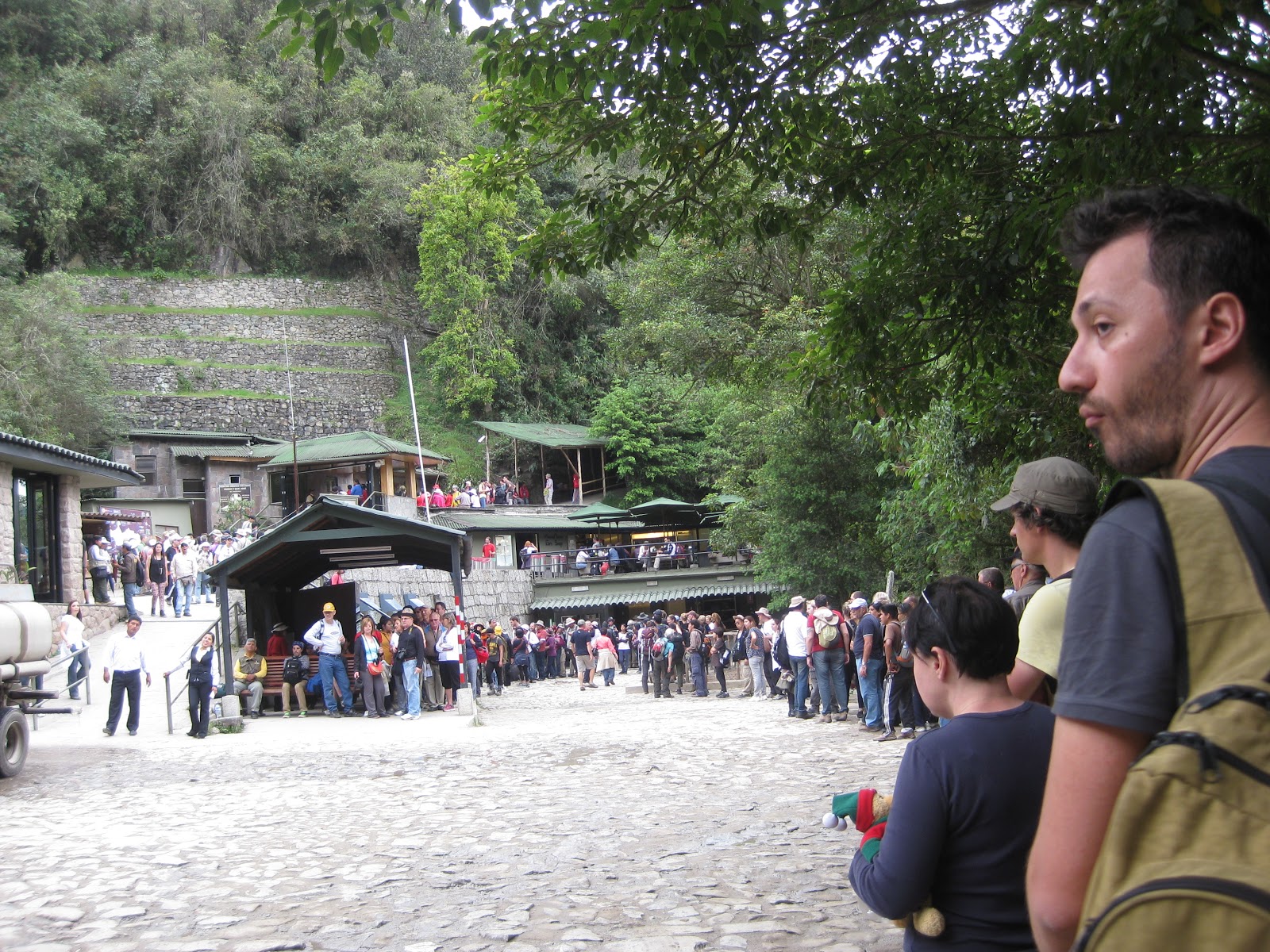
A very long queue for the bus

What to bring

Most trekking companies have very comprehensive "what to bring" list. The 2 most important items for me would been the sun screen and the insect repellant. Just apply and reapply diligently.

If you are trekking independently, bring a tent and not a hammock. We really saw someone with a hammock. Isn't it heavy? Also, not all campsites have 2 trees or structures to put up a hammock. Let's not also forget that it can rain any night.


Choquequirao to Machu Picchu : Best and Worst

Best parts of the trip
1. Choquequirao's llama walls - mystical.
2. Waking up to great views of the mountains every morning.


Worst parts of the trip
1. Wet tent from rain. I think people generally sleep light at higher altitude. After the wet tent incident, I wake up every hour every night to check if there is rain and if my tent is leaking. ¡No es bueno!
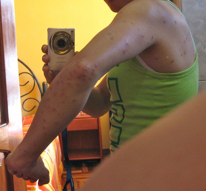
2. Bites. I think I have about 150 mosquito/ fly bites on me - 50 on each arm and 50 on both feet. 
VERY GROSS right?
Most refreshing
Having 2 showers in glacier water. We wanted a shower so much that the icy cold water did not matter. Having said that, I could only manage to stand in the shower for maybe 3 minutes at any one go, before I jumped out to breathe, then hold my breath and jump in again.


Most repetitive
Song on a broken heart that was played on Astario's radio station day and night. It goes "mi corazón..." and it was played sooooo often that Buddy knew how to sing the song. 


Noisiest
Roosters. I was so ready to slaughter them. They would crow from 3am, non-stop, in their hoarse voice. There was no sun and no competitors. I really do not understand why they walked around my tent and crow and crow and crow.


Longest switchback
On Day 4, on our way to Maizal camp. This is what the longest stretch looked like from our Pinchaunuyoc camp:
Switchback marked in yellow
For me, the worst part of this switchback was not the length but the sun.


Saturday, 24 November 2012

Choquequirao to Machu Picchu : Machu Picchu

Machu Picchu (“old mountain” in Quechua) was both a centre of worship and astronomic observatory as well as the private retreat of the family of Inca ruler Pachacutec. The city has 2 main areas: the agriculture zone (terraces, food warehouses) and the urban zone (temples, squares and royal tombs). (www.visitperu.com)


Machu Picchu is supposed to be a spiritual place but unlike Choquequirao's llama wall, I really did not feel anything "spiritual' at all. Maybe this is because Machu Picchu was overrun by tourists. To me, it is at best a very interesting archaeology site.

When we arrived at Machu Picchu, it was drizzling and the Inca city was below the clouds, and we could not see anything below us:

Needless to say, I was disappointed and very worried that the clouds would not go away. Eventually, we did have a good aerial view of the lost city:
Left: Waynapicchu, Centre: The urban zone, Right: Terraces from the rural zone
Left: Montaña Machu Picchu
Chakana (Inca Cross)
The most amazing thing of all is probably how the stone masons put the whole city together with stones of different sizes and shapes. One of the stones even have 32 sides!


Buddy and I walked ascended Waynapicchu, the highest mountain (2693m) closest to the city. From this height, some say that the city is shaped like a condor:
View from Waynapicchu
From Waynapicchu, we made a detour to the Great Cave, where there was more of the ancient city hidden.


Great Cave
Wild hen
As we had to leave for Cuzco in the afternoon, we had to give Montaña Machu Picchu and Inti Punku and Inca Bridge a miss.


Thursday, 22 November 2012

Choquequirao to Machu Picchu : Days 6 - 8

Day 6 Yanama to Totora

For the third consecutive day, I woke up with puffy eyes. Terribly puffy eyes, like I had been brawling my eyes out all night. I know I have small eyes but this really took it to another level as I could hardly see anything. I looked at my reflection in the mirror and saw only 2 fine lines, like this:
Do I look like Brock from Pokemon?
This was the max my eyes could open.
See - I said it was bad. Very bad. 
José thought it was due to the fact that I have been sleeping too much. I was worried that this was a symptom for acute mountain sickness or food/bite allergy that I was not aware of. [I decided to check online as I wrote this entry and found that "Swelling beneath the skin (oedema), typically around the eyes and in some cases swollen ankles and hands" is a serious symptom for altitude sickness and "medical attention must be sought immediately, and the patient brought down to the lowest possible height". I am not sure if online medical advices can be trusted but OOOOPS!]


We had an interesting start. Soon after we started out, we saw a villager running towards us, shouting for us to get out of the way. We jumped onto the slope. Then dogs ran passed. It turned out that the villagers were running with a bull from one end of the town to the school:
The bull would be slaughtered for the school's celebrations and the whole village would turn up in force. If only we start out 1 day later. We would then be able to join in the festivities.

An eagle soared in the sky as we continued an ascent along the path, along a river and passing by some waterfalls, glaciers and snow-capped mountains. My climbing theory was proven correct again. Yesterday's descent from Abra San Juan to Yanama meant that today we had to climb first to recover the altitude lost and then some more to Yanama pass (4850m), the highest point of our trek. The initial gentle ascent was followed by some scrambles (due to construction of a road to link Yanama to the next town) and switchbacks up to Yanama pass.

The weather was not great and the wind factor did not help. I did not have my jacket with me and had to battle the wind as we made our way up. I was slightly out of breath (not sure if it was the altitude or my lack of fitness) but I finally made it.
Yanama pass
Photo credit: José
We saw an Andean condor circling the sky as we descended from Yanama pass. We saw roads for the first time since Day 1 and at the moment, roads are being built to link the next village to Yanama. After a quick lunch, we descended some more via a scenic route through farms (including trout farms) and reached another village called Totora. 

We camped in the backyard of a villager. Johan and Gunda would be leaving us tomorrow. Astario cooked us cuys (guinea pig), which the Andeans serve on special occasions. 
Cuys
The boys indulged me and joined us at the dinner table.
Buddy, José, Johan (standing), Gunda in red, Astario

Day 7 Totora to Lucmabamba

Today was supposed to be "a whole day of descending" as we made our way to the village La Playa. At best, it was "Peruvian flat", which essentially meant that there were lots of ups and downs. We also joined the the Salkantay trek from this point and we suddenly saw more trekkers.

I had woken up with puffy eyes again and started to have pins and needles on my face. The pins and needles travelled down from the areas around my eyes to my cheeks and by the time I reached La Playa, my collar bones. If this were to travel to my chest, I would have freaked out but fortunately, the tingling feeling finally stopped before noon.

We powered pass the newbies from the Salkantay trek and had lunch at Lucmabamba. From there, we drove to the town Santa Theresa to camp. In the late afternoon, we took a local bus to the hot springs for a soak. There is no volcano in the area. I was told that the water from the glaciers were forced underground and came up hot (I am really not sure how that works). It seemed like everyone on the trek was there. So were the locals who came with their families or friends.  
Hot springs

Day 8 Santa Theresa to Aguas Calientes 

Today was a complete waste of time. Buddy and I did not take up an additional activity to try a zipline across canopy. Also, as our fee covered a train ticket to Aguas Calientes, we decided to take the train instead of trek. The train did not depart until 4pm and we just hung around the train station, waiting. 


Aguas Calientes is the nearest town to Machu Picchu, with many accommodation and dining options and a big market selling souvenirs. As expected, there were many tourists around the town.


The best thing about Aguas Calientes though was the hot shower at our hostel. I washed my hair twice. How good it was to be clean and smell fresh. 

One more sleep to Machu Picchu.

Wednesday, 21 November 2012

Choquequirao to Machu Picchu : Days 4 - 5

Day 4 Pinchinuyoc to Maizal

We had breakfast
and bade farewell to Pinchinuyoc.
Pinchinuyoc terraces and the switchback to the river (zigzag lines on the left)
Steep ascent

From Pinchinuyoc, we descended the canyon to Rio Bianco. We crossed the river and climbed up again to our campsite at Maizal. Today's ascent was more difficult because of the steepness and the heat. It did not help that we had to climb from the river bed. Hence the sudden realisation: "Fact of climbing: What goes down, must go up and up and up. Then some more (URGH!)". 


It was soooooo hot and there was barely any shade from the trees. I had not been perspiring as much since I was training for my nationals when I was 18. Back then, I would perspire so much and the sun evaporate the perspiration so quickly that salt would be left on my arms. When we reached our camp, Buddy had to tell me there was salt on my singlet. Thanks Buddy! Funny enough, the salt lines resembled the waterfall across the valley. Don't you think so?

L: Salt lines on singlet. R: Waterfall across the valley

Day 5 Maizal to Yanama

We finally saw the glaciers in front of our camp in the crisp morning air and clear sky.
View from camp
From our camp at 3000m, we were to ascend to the second highest point of our trek, Abra San Juan (4150m). There were many pretty flowers and butterflies along the way. The butterflies were so busy that this was also the first time I could feel the strong flutter of their wings (don't they normally just float around?). 


Humming bird

We also walked passed many caves, entrances to the 'Minas Victoria', silver mines in the colonial time.
Next, we came to an original Inca trek. This was part of the extensive 40,000km network built by the Incas that connect Cuzco (Peru) to the Quito (Ecuador) in the North, Santiago (Chile) in the South and Mendoza (Argentina) in the East.
The Inca trek led us to Abra San Juan, where chef Astario miraculously produced lunch:
I had to hang on to my chair in case I lost my balance or got blown away
Photo credit: José
By the time I arrived at the pass, the clouds were down.
Astario tried to blow the clouds away but I could only manage to see sections of the glacier tops at any one time. The low clouds also kept the condors away. I pleaded and willed the sky to clear but waited in vain.
Photo credit: José
Soon, we had to  make our way down to Yanama, home to Astario and muleteers Gunda and Johan.
Approaching Yanama
We saw domestic animals such as pigs: 

and guinea pigs:

It was the local primary school's anniversary and the students, including the children of the villager whose backyard we camped in, made paper lanterns and took part in a parade around the village at night. After dinner, we went to the school to join the villagers in their celebrations, where the students performed.